Array
(
[id] => 48dd1833-a29d-4a3b-b74f-c148341b35db
[version] => 68
[active] => 1
[publish] => 1
[created] => 2016-10-02 15:20:43
[lastmodified] => 2024-10-17 11:18:15
[createdby] => 1138
[lastmodifiedby] => 1140
[domain_id] => 6813
[office_id] =>
[menu_id] =>
[title_bn] => চেয়ারম্যান, বাসেক বোর্ড
[title_en] => Chairman, BBA Board
[body_bn] =>
[body_en] =>
[userpermissionsids] =>
[uploadpath] => 42d41c58-2d59-4f5e-b14e-7e94c81a30fd
[userip] => 127.0.0.1
[useragent] => Mozilla/5.0 (Windows NT 10.0; Win64; x64) AppleWebKit/537.36 (KHTML, like Gecko) Chrome/129.0.0.0 Safari/537.36
[usergeo] =>
[is_right_side_bar] => 0
[office_head_photo] => Array
(
[0] => Array
(
[name] => 2024-09-17-05-07-fdc0bbc0dedefecaa6c04ed92515ecb3.jpg
[caption_bn] => চেয়ারম্যান, বাসেক বোর্ড
[caption_en] => Chairman, BBA Board
[link] =>
)
)
[office_head_description] => মাননীয় মন্ত্রী জনাব ওবায়দুল কাদের মাননীয় মন্ত্রী, সড়ক পরিবহন ও সেতু মন্ত্রণালয় ওবায়দুল কাদের একটি সুদীর্ঘ ও সমৃদ্ধ রাজনৈতিক জীবনের অধিকারী। একজন সংস্কৃতিমনষ্ক, উদার, প্রজ্ঞাবান, বাগ্মী, স্পষ্টবাদী, ত্যাগী ও নিষ্ঠাবান রাজনৈতিক নেতা হিসাবে তাঁর পরিচিতি। ওবায়দুল কাদের বসুরহাট সরকারি এ.এইচ.সি উচ্চ বিদ্যালয় থেকে প্রথম বিভাগে এস.এস.সি ও নোয়াখালী কলেজ থেকে মেধা তালিকায় স্থান সমেত এইচ.এস.সি পাশ করেন। অতঃপর ঢাকা বিশ্ববিদ্যালয় থেকে রাষ্ট্রবিজ্ঞানে অনার্সসহ স্নাতক ডিগ্রী লাভ করেন। তিনি কলেজ জীবন থেকে ছাত্র রাজনীতি শুরু করেন। ১৯৬৬ সালে ৬ দফা আন্দোলন এবং ১৯৬৯ সালে গণ আন্দোলন ও ছাত্রদের ১১ দফা আন্দোলনে সক্রিয় ভূমিকা পালন করেন।
[office_head_des_bn] => মুহাম্মদ ফাওজুল কবির খান
মাননীয় উপদেষ্টা, সড়ক পরিবহন ও সেতু মন্ত্রণালয়।
মুহাম্মদ ফাওজুল কবির খান। সাবেক বিদ্যুৎ–সচিব। বোস্টন বিশ্ববিদ্যালয় থেকে তিনি অর্থনীতিতে পিএইচডি ডিগ্রি লাভ করেন। বেসরকারি খাতে অবকাঠামো উন্নয়ন অর্থায়ন প্রতিষ্ঠান ইডকলের প্রথম পূর্ণকালীন সিইও হিসেবে তিনি এর ভিত গড়েন। তাঁর লেখা (সহলেখক বব পারা) বই ফাইন্যান্সিং লার্জ প্রজেক্ট পিয়ারসন কর্তৃক প্রকাশিত ও চীনা ভাষায় অনূদিত হয়েছে। তাঁর দ্বিতীয় বই উইন-হাউ পাবলিক এন্ট্রাপ্রেনিউরশিপ ক্যান ট্রান্সফর্ম দ্য ডেভেলপিং ওয়ার্ল্ড ফরাসি ও পর্তুগিজ ভাষায় অনূদিত হচ্ছে। যুক্তরাষ্ট্র, সিঙ্গাপুর ও দেশের বিভিন্ন বিশ্ববিদ্যালয়ে অধ্যাপনার পাশাপাশি তিনি বিশ্বব্যাংক, এডিবি, জাইকা, ইউএনডিপিসহ বিভিন্ন আন্তর্জাতিক সংস্থার পরামর্শক হিসেবে কাজ করেছেন। তিনি দু:স্থ প্রবীণদের বিনামূল্যে সেবাদানকারী প্রতিষ্ঠান শৈলান প্রবীণ নিবাসের উপদেষ্টা মন্ডলীর একজন সদস্য।
[office_head_des_en] => Muhammad Fouzul Kabir Khan
Hon'ble Advisor, Ministry of Road Transport and Bridges.
মুহাম্মদ ফাওজুল কবির খান। সাবেক বিদ্যুৎ–সচিব। বোস্টন বিশ্ববিদ্যালয় থেকে তিনি অর্থনীতিতে পিএইচডি ডিগ্রি লাভ করেন। বেসরকারি খাতে অবকাঠামো উন্নয়ন অর্থায়ন প্রতিষ্ঠান ইডকলের প্রথম পূর্ণকালীন সিইও হিসেবে তিনি এর ভিত গড়েন। তাঁর লেখা (সহলেখক বব পারা) বই ফাইন্যান্সিং লার্জ প্রজেক্ট পিয়ারসন কর্তৃক প্রকাশিত ও চীনা ভাষায় অনূদিত হয়েছে। তাঁর দ্বিতীয় বই উইন-হাউ পাবলিক এন্ট্রাপ্রেনিউরশিপ ক্যান ট্রান্সফর্ম দ্য ডেভেলপিং ওয়ার্ল্ড ফরাসি ও পর্তুগিজ ভাষায় অনূদিত হচ্ছে। যুক্তরাষ্ট্র, সিঙ্গাপুর ও দেশের বিভিন্ন বিশ্ববিদ্যালয়ে অধ্যাপনার পাশাপাশি তিনি বিশ্বব্যাংক, এডিবি, জাইকা, ইউএনডিপিসহ বিভিন্ন আন্তর্জাতিক সংস্থার পরামর্শক হিসেবে কাজ করেছেন। তিনি দু:স্থ প্রবীণদের বিনামূল্যে সেবাদানকারী প্রতিষ্ঠান শৈলান প্রবীণ নিবাসের উপদেষ্টা মন্ডলীর একজন সদস্য।
[designation] =>
[designation_new_bn] => চেয়ারম্যান, বাসেক বোর্ড
[designation_new_en] => Chairman, BBA Board
[weight] => 70
)
=======================Array
(
[id] => 0234252a-6915-4a7a-9bf5-3a6fb88393f0
[version] => 22
[active] => 1
[publish] => 1
[created] => 2025-04-01 13:57:44
[lastmodified] => 2025-04-08 12:18:26
[createdby] => 1140
[lastmodifiedby] => 1140
[domain_id] => 6813
[office_id] =>
[menu_id] =>
[title_bn] => মাননীয় প্রধান উপদেষ্টার বিশেষ সহকারী
[title_en] => Special Assistant to the Hon'ble Chief Advisor
[body_bn] =>
[body_en] =>
[userpermissionsids] =>
[uploadpath] => df9cf3e9-fc85-4094-a7e9-acc371f070c1
[userip] => 127.0.0.1
[useragent] => Mozilla/5.0 (Windows NT 10.0; Win64; x64) AppleWebKit/537.36 (KHTML, like Gecko) Chrome/134.0.0.0 Safari/537.36
[usergeo] =>
[is_right_side_bar] => 0
[office_head_photo] => Array
(
[0] => Array
(
[name] => 2025-04-07-06-40-f3a91ef6dfb863c64bfbde60022b1164.jpg
[caption_bn] =>
[caption_en] =>
[link] =>
)
)
[office_head_description] =>
[office_head_des_bn] => শেখ মইনউদ্দিন
মাননীয় প্রধান উপদেষ্টার বিশেষ সহকারী
[office_head_des_en] => Sheik Moinuddin
Special Assistant to the Hon'ble Chief Advisor
[designation] =>
[designation_new_bn] => মাননীয় প্রধান উপদেষ্টার বিশেষ সহকারী
[designation_new_en] => Special Assistant to the Hon'ble Chief Advisor
[weight] => 2
)
=======================Array
(
[id] => 0bea7388-926c-40c5-8f67-44f7e6c01da6
[version] => 146
[active] => 1
[publish] => 1
[created] => 2016-10-02 15:32:14
[lastmodified] => 2025-03-02 11:57:35
[createdby] => 1138
[lastmodifiedby] => 1140
[domain_id] => 6813
[office_id] =>
[menu_id] =>
[title_bn] => মোহাম্মদ আবদুর রউফ
[title_en] => Mohammad Abdur Rouf
[body_bn] =>
[body_en] =>
[userpermissionsids] =>
[uploadpath] => 80318052-2c97-460a-af18-3f7c27856ed0
[userip] => 127.0.0.1
[useragent] => Mozilla/5.0 (Windows NT 10.0; Win64; x64) AppleWebKit/537.36 (KHTML, like Gecko) Chrome/133.0.0.0 Safari/537.36
[usergeo] =>
[is_right_side_bar] => 0
[office_head_photo] => Array
(
[0] => Array
(
[name] => 2025-02-26-12-08-539c21f7089a91160e03cffe258d3add.jpg
[caption_bn] => নির্বাহী পরিচালক
[caption_en] => Executive Director
[link] => https://bba.portal.gov.bd/site/office_head/0bea7388-926c-40c5-8f67-44f7e6c01da6
)
)
[office_head_description] => MOHAMMED BELAYET HOSSAIN
[office_head_des_bn] => মোহাম্মদ আবদুর রউফ
সচিব, সেতু বিভাগ
ও
নির্বাহী পরিচালক, বাংলাদেশ সেতু কর্তৃপক্ষ
জনাব মোহাম্মদ আবদুর রউফ গত ২৫ ফেব্রুয়ারি ২০২৫ তারিখ গণপ্রজাতন্ত্রী বাংলাদেশ সরকারের সচিব পদে পদোন্নতি প্রাপ্ত হয়ে গত ২৬ ফেব্রুয়ারি ২০২৫ তারিখ সেতু বিভাগের সচিব ও বাংলাদেশ সেতু কর্তৃপক্ষের নির্বাহী পরিচালক হিসেবে যোগদান করেন। তিনি এই দায়িত্ব গ্রহণের পূর্বে গত ০৯ সেপ্টেম্বর ২০২৪ তারিখ থেকে ২৫ ফেব্রুয়ারি ২০২৫ তারিখ পর্যন্ত শতভাগ সরকারি মালিকানাধীন ঢাকা মেট্রোরেল এর স্বত্বাধিকারী প্রতিষ্ঠান ঢাকা ম্যাস ট্রানজিট কোম্পানি লিমিটেড (ডিএমটিসিএল) এর ব্যবস্থাপনা পরিচালকের দায়িত্ব পালন করেন। তিনি ব্যবস্থাপনা পরিচালকের দায়িত্বে থাকাকালীন সময়ে ২০২৪ সালে জুলাই-আগস্টে আন্দোলনের সময় মেট্রোরেলে ক্ষতিগ্রস্ত কাজিপাড়া ও মিরপুর-১০ স্টেশন দুটি স্বল্প ব্যয়ে ও দ্রুত সময়ে পুন:নির্মাণ করে চলাচলের ব্যবস্থা করেন। তিনি গত ০৯ জুলাই ২০২০ থেকে গত ২৪ আগস্ট ২০২৪ তারিখ পর্যন্ত ঢাকা ম্যাস র্যাপিড ট্রানজিট ডেডেলপমেন্ট প্রজেক্ট (লাইন-৫): নর্দার্ন রুট এর অতিরিক্ত প্রকল্প পরিচালক (অর্থ ও প্রশাসন) এবং ঢাকা ম্যাস ট্রানজিট কোম্পানি লিমিটেড (ডিএমটিসিএল) এর কোম্পানি সচিব (যুগ্মসচিব) হিসেবে দায়িত্ব পালন করেছেন। এছাড়াও তিনি MRT Line-6 এর অতিরিক্ত প্রকল্প পরিচালক (অর্থ ও প্রশাসন), MRT Line-5: Northern Route এর অতিরিক্ত প্রকল্প পরিচালক (ই এন্ড এইচএস, এলএ এন্ড রিসেটেলমেন্ট) এবং পরিচালক (প্রশাসন) হিসেবেও দায়িত্ব পালন করেছেন। ঢাকা মেট্রোরেলে বিভিন্ন পর্যায়ে দীর্ঘদিন দায়িত্ব পালনের সুবাদে কোম্পানি এ্যাফেয়ার্স, ভূমি, প্রশাসনিক ও আর্থিক ব্যবস্থাপনা, মেট্রোরেল বাস্তবায়ন, পরিচালনা ও রক্ষণাবেক্ষণ এবং সেফটি ম্যানেজমেন্ট সিস্টেম বিষয়ে তিনি সম্যক অভিজ্ঞতা অর্জন করেছেন। তিনি ১৯৯৪ সালে বাংলাদেশ সিভিল সার্ভিস প্রশাসন ক্যাডারে যোগদান করেন। তাঁর রয়েছে সুদীর্ঘ বর্ণাঢ্য কর্মজীবন। দীর্ঘ চাকুরি জীবনে তিনি মাঠ প্রশাসন, জাতীয় সংসদ সচিবালয় ও রপ্তানি উন্নয়ন ব্যুরোতে কাজ করেছেন।
জনাব মোহাম্মদ আবদুর রউফ বাংলাদেশ সিভিল সার্ভিস প্রশাসন ক্যাডারের ১৩তম ব্যাচের সদস্য হিসেবে মাঠ পর্যায়ে সহকারী কমিশনার ও ম্যাজিস্ট্রেট, উপজেলা নির্বাহী অফিসার, বিভিন্ন জেলায় অতিরিক্ত জেলা প্রশাসক, অতিরিক্ত জেলা ম্যাজিস্ট্রেট এবং উপপরিচালক স্থানীয় সরকার হিসেবে দায়িত্ব পালন করেছেন। মাঠ প্রশাসনে দায়িত্ব পালনকালে সুশাসন ও উন্নয়ন কার্যাদির বাস্তবতা সম্পর্কে তিনি সম্যক অবহিত হন। এছাড়াও তিনি রপ্তানি উন্নয়ন ব্যুরোতে উপপরিচালক (অর্থ) হিসেবে দায়িত্ব পালন করেন। তিনি ০৩ (তিন) বার ঢাকা আন্তর্জাতিক বাণিজ্য মেলার মেলা সচিবের দায়িত্ব সাফল্যের সঙ্গে পালন করেন এবং পণ্য বহুমুখিকরণের মাধ্যমে বাংলাদেশের রপ্তানি বাণিজ্য সম্প্রসারণে গুরুত্বপূর্ণ অবদান রাখেন।
শিক্ষা জীবনে জনাব মোহাম্মদ আবদুর রউফ কুমিল্লা জেলার চৌদ্দগ্রাম উপজেলাস্থ ধোড়করা উচ্চ বিদ্যালয় থেকে কৃতিত্বের সাথে বিজ্ঞান বিভাগে এসএসসি এবং কুমিল্লা ভিক্টোরিয়া সরকারি কলেজ থেকে এইচএসসি পাশ করেন। পরবর্তীতে তিনি চট্টগ্রাম বিশ্ববিদ্যালয় হতে রাজনীতি বিজ্ঞান বিষয়ে সম্মান ও স্নাতকোত্তর ডিগ্রি অর্জন করেন। উল্লেখ্য যে, তিনি স্নাতকোত্তর পর্যায়ে প্রথম স্থান অধিকার করে কৃতিত্বের স্বাক্ষর রাখেন।
তিনি অস্ট্রেলিয়ার মেলবোর্ন এর Monash University ও সিডনির Macquarie University থেকে উন্নয়ন প্রশাসনের উপর এবং KOICA এর আওতায় দক্ষিণ কোরিয়ার Kangwon National University ও Netherlands এর Rotterdam Trade Centre থেকে আন্তর্জাতিক বাণিজ্যনীতির উপর উচ্চতর প্রশিক্ষণ গ্রহণ করেছেন। এছাড়াও Mid-Career Training for Civil Servant of Bangladesh এর আওতায় ভারতের Lal Bahadur Shastri National Academy of Administration থেকে মাঠ প্রশাসন ও ভিয়েতনামের National Training Academy থেকে উন্নয়ন প্রশাসন এবং চীনের উহানে Information & Communication Technology বিষয়ে উচ্চতর প্রশিক্ষণ গ্রহণ করেছেন। তিনি JICA’র আওতায় জাপানের টোকিও ও ওসাকাতে জাপানের Metro Rail Construction, Operation, Maintenance & Safety Management System বিষয়ে প্রশিক্ষণ গ্রহণ করেছেন। তিনি চীনের Beijing Jiaotong University থেকে Metro Management and Service for Bangladesh বিষয়ে এবং জাপানের Hokkaido-তে JICA’র আয়োজনে Public Participation, Consensus Building and Resettlement in Public Works Project এর উপর online প্রশিক্ষণ গ্রহণ করেছেন।
জনাব মোহাম্মদ আবদুর রউফ, তাঁর বর্ণাঢ্য কর্মজীবনে সেমিনার, প্রশিক্ষণ, নেগোসিয়েশন এবং পেশাগত প্রয়োজনে অস্ট্রেলিয়া, চীন, জাপান, জার্মানি, তুরস্ক, থাইল্যান্ড, দক্ষিণ কোরিয়া, নেদারল্যান্ডস, ফ্রান্স, ফিজি, বেলজিয়াম, ভারত, ভিয়েতনাম, মালয়েশিয়া, যুক্তরাষ্ট্র, শ্রীলংকা, সিঙ্গাপুর, হংকং প্রভৃতি দেশে ভ্রমণ করেন।
জনাব মোহাম্মদ আবদুর রউফ মরহুম মৌঃ মোঃ আবদুল মান্নান ও মরহুমা বেগম সালেহা আক্তার দম্পতির তৃতীয় সন্তান। তিনি কুমিল্লা জেলার চৌদ্দগ্রাম উপজেলার চিওড়া ইউনিয়নের সাতঘরিয়া গ্রামে ১৯৬৭ সালে জন্মগ্রহণ করেন। তাঁর স্ত্রী’র নাম জনাব মাহফুজা জাফরীন নিক্কন এবং তিনি এক পুত্র ও এক কন্যা সন্তানের জনক। বই পড়া, বড়শিতে মাছ শিকার, ভ্রমণ, কবিতা আবৃত্তি এবং মানবিক কার্যক্রমে সম্পৃক্ত থাকা তাঁর অন্যতম শখ।
[office_head_des_en] => Mohammad Abdur Rouf
Secretary, Bridges Division
&
Executive Director, Bangladesh Bridge Authority
Mr. Mohammad Abdur Rouf was promoted to the post of Secretary to the Government of the People's Republic of Bangladesh on February 25, 2025 and joined as the Secretary of the Bridges Division and Executive Director of the Bangladesh Bridge Authority on February 26, 2025. Before assuming this responsibility, he served as the Managing Director of Dhaka Mass Transit Company Limited (DMTCL), the wholly government-owned Dhaka Metrorail from 09 September 2024 to 25 February 2025. During his tenure as the Managing Director, he rehabilitated Kazipara and Mirpur-10 stations, which were damaged during the July-August agitation in 2024, at a low cost and quickly. He served as Additional Project Director (Finance and Administration) of Dhaka Mass Rapid Transit Development Project (Line-5): Northern Route and Company Secretary (Joint Secretary) of Dhaka Mass Transit Company Limited (DMTCL) from 09 July 2020 to 24 August 2024. He also worked as the Additional Project Director (Finance and Admin) of MRT Line-6 and Additional Project Director (E&HS, LA & Resettlement) and Director (Admin) of MRT Line-5: Northern Route. He gathered much knowledge about company affairs, land management, administrative and financial Management, implementation, operation, maintenance and safety management system of Metro Rail while performing his duties in these positions. He joined the Bangladesh Civil Service cadre in 1994. During his long and illustrious career, he has served at the field administration, National Parliament Secretariat and Export Promotion Bureau as well.
As a member of the 13th Batch of Bangladesh Civil Service Administration Cadre, Mr. Mohammad Abdur Rouf served at the field level as Assistant Commissioner and Magistrate, Upazila Nirbahi Officer, Additional District Commissioner (General), Additional District Commissioner (Revenue), Additional District Magistrate and Deputy Director of Local Government at several Districts. While performing at the field level administration, he became well-versed in the realities of good governance and development activities. He also served as Deputy Director (Finance) at the Export Promotion Bureau. He successfully caried out his duties as the Secretary of the Fair organized by Dhaka International Trade Fair for 03 (three) times and contributed significantly to the expansion of trade in Bangladesh through product diversification.
In his academic life, Mr. Mohammad Abdur Rouf passed SSC (Science) from Dhorkora High School and HSC from Victoria Government College under Cumilla district with distinction. He obtained his Honors and Master's Degrees in Political Science from Chattogram University. It is to be noted that he secured the first position in his class at the post-graduate level.
He has received advanced training in Development Administration from Monash University, Melbourne, Australia and Macquarie University, Sydney, and International Trade Policy from Kangwon National University, South Korea and Rotterdam Trade Center, Netherlands under KOICA.
As Mid-Career Training for Civil Servant of Bangladesh he received advanced training in Field Administration from Lal Bahadur Shastri National Academy of Administration in India, Development Administration from National Training Academy in Vietnam and Information & Communication Technology training in Wuhan, China. He has received training on Japan's Metro Rail Construction, Operation, Maintenance & Safety Management System in Tokyo and Osaka under JICA. He has received online training on Metro Management and Service for Bangladesh from Beijing Jiaotong University, China and on Public Participation, Consensus Building and Resettlement in Public Works Project organized by JICA in Hokkaido, Japan.
In his illustrious career, Mr. Mohammad Abdur Rouf has travelled to Australia, China, Japan, Germany, Turkey, Thailand, South Korea, Netherlands, France, Fiji, Belgium, India, Vietnam, Malaysia, USA, Sri Lanka, Singapore and Hong Kong for professional purpose and to attend at various seminars, training, negotiation etc.
Mr. Mohammad Abdur Rouf is the third child of late Md. Abdul Mannan and late Begum Saleha Akhtar. He was born in 1967 in Satgharia village of Chiora union of Chauddagram Upazila under Cumilla district. His wife's name is Mrs. Mahfuza Zafrin Nikkon and he is blessed with a son and a daughter. He takes keen interest in engaging himself in humanitarian activities among other hobbies such as reading, fishing, traveling and reciting poetry.
[designation] =>
[designation_new_bn] => নির্বাহী পরিচালক
[designation_new_en] => Executive Director
[weight] => 2
)
=======================
চেয়ারম্যান, বাসেক বোর্ড
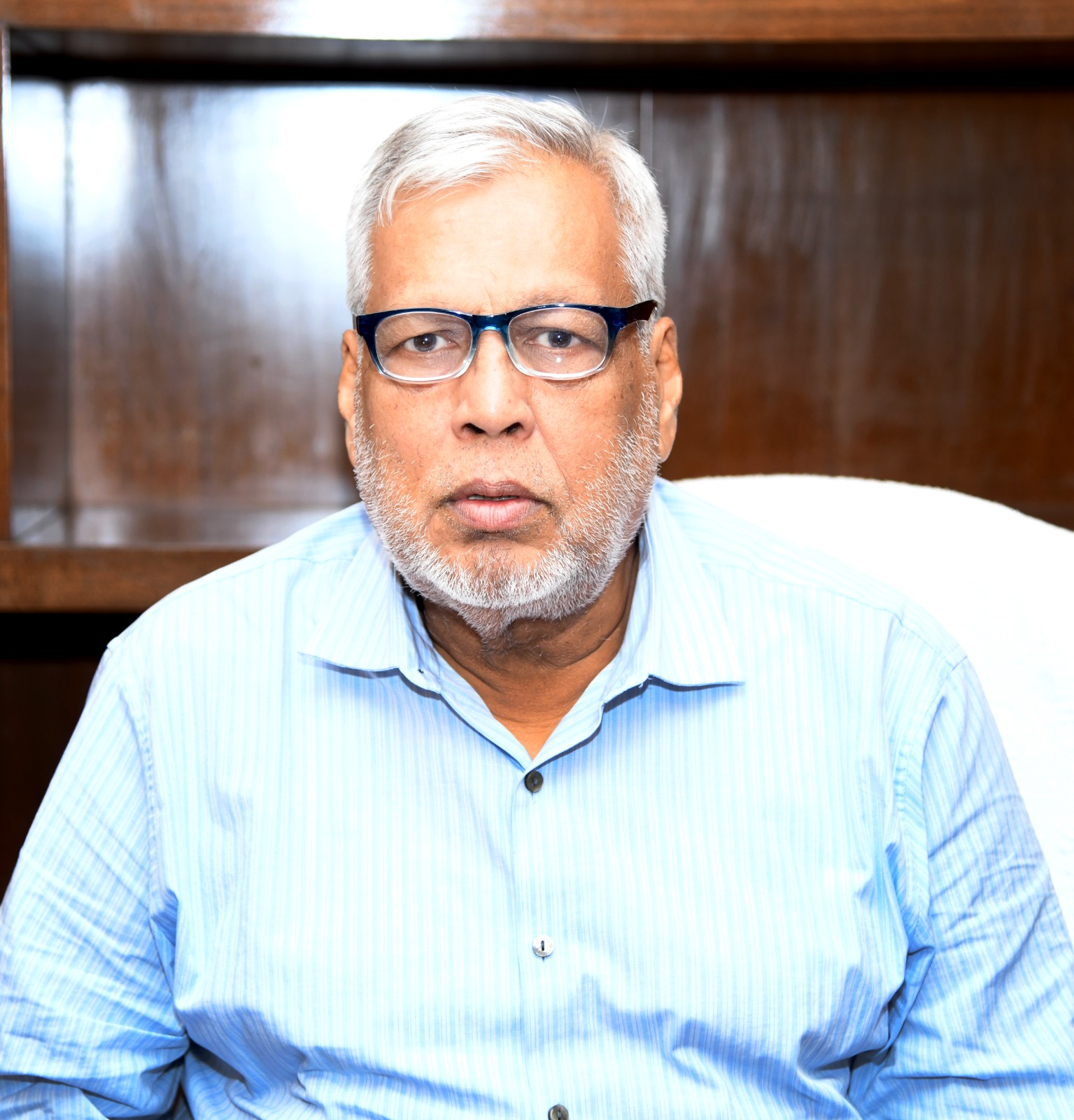
মুহাম্মদ ফাওজুল কবির খান
মাননীয় উপদেষ্টা, সড়ক পরিবহন ও সেতু মন্ত্রণ...
বিস্তারিত
মাননীয় প্রধান উপদেষ্টার বিশেষ সহকারী
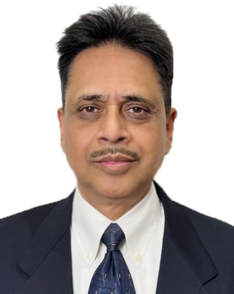
শেখ মইনউদ্দিন
মাননীয় প্রধান উপদেষ্টার বিশেষ সহকারী
বিস্তারিত
নির্বাহী পরিচালক
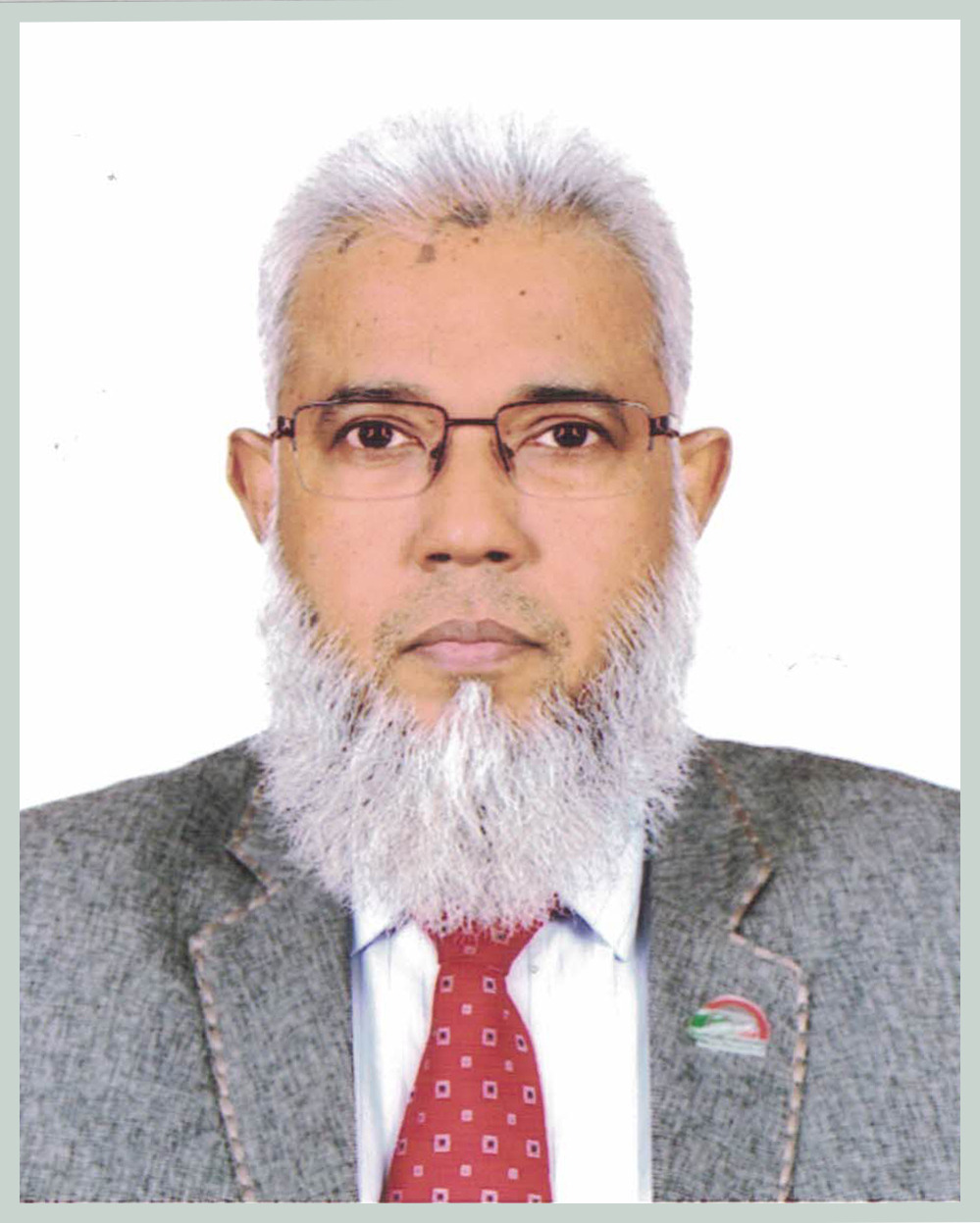
মোহাম্মদ আবদুর রউফ
সচিব, সেতু বিভাগ
ও
নির্বাহী ...
বিস্তারিত
কেন্দ্রীয় ই-সেবা
জরুরি হেল্পলাইন নম্বর